 Loading... Please wait...
All prices are in All prices are in AUD
Categories
- Home
- Giclee Prints
- Map Giclee Gulf Spencer Saint Vincent Baudin Freycinet 1803
- Home
- Giclee Prints
- Maps and Charts
- Map Giclee Gulf Spencer Saint Vincent Baudin Freycinet 1803
- Home
- Giclee Prints
- Maps and Charts
- Nicolas Baudin 1800 to 1804
- Map Giclee Gulf Spencer Saint Vincent Baudin Freycinet 1803
- Home
- Giclee Prints
- Maps and Charts
- Australia-Asia-Pacific
- Map Giclee Gulf Spencer Saint Vincent Baudin Freycinet 1803
Product Description
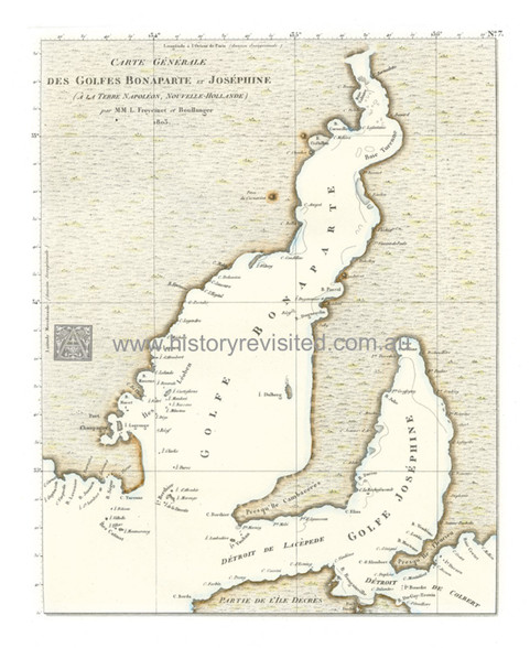
Map, Giclee, Chart, Gulfs of St. Vincent and Spencer, South Australia, 1803, Nicolas Baudin Louis de Freycinet, Bonaparte, Josephine
"Carte generale des Golfes Bonaparte et Josephine (a la Terre Napoleon, Nouvelle Hollande)/ par M.M.L. Freycinet et Boullanger 1803"
Archival Limited Edition Giclee Print after an original chart printed in 1811-12, original was hand tinted.
Printed on archival quality conservation cotton paper limited edition to 350 Giclee prints.
Issued with South Australian key to source of surviving French names.
Size same as original chart = 19 x 22cm (7 1/2 x 8 3/4 inch)
Nicolas Baudin Scientific Voyage of Discovery (1800-1804)
This detailed French chart of the gulfs, first appeared in the Nicolas Baudin's French Voyage of Discovery from 1800-1804. The French atlas published in Paris, 1811-12. The gulfs appear on the larger map of "Carte General De la Terre Napoleon..." (South-East Coast of Australia), but are detailed here to focus attention on the illustrious names of the Emperor Napoleon Bonaparte and Empress Josephine of France, during that period. Fleurieu Peninsula was also significant as Charles Pierre Claret de Fleurieu (1738-1810), an explorer, hydrographer & member of the Bureau des Longitudes, the body that designated exploration itineraries. He was great favourite of Napoleon's, who, on his death, gave him a state funeral.
Matthew Flinders' maps returned to England in 1810 after he was detained on French Mauritius by its French Governor General Charles Mathieu Isidore Decaen, for 6 years. After the publication of the English Voyage's Account and Atlas belatedly in 1814, the cartography predated Baudin's efforts. The French eventually republished these maps, but not until 1825 and there was no political need for this chart as Napoleon Bonaparte and Josephine were vanquished. Matthew Flinders chose Spencer and St. Vincent after Lords of the British Admiralty.
Product Videos
-
 Encounter Cele...Select 1080P for best quality picture. This brief video tells ...
 -
 The Navigators...
Other Details
Product Reviews
-
The 'What if the French colonised first" map

Posted by Stephen M on 1st Dec 2022
Thanks to Sandra for providing lots of additional historical information on the map and the period in which it was created. This extra text is attached to the framed map for future refefence.
-
Amazing History!

Posted by Carola on 3rd Jan 2013
I am saving up for the tallship that sailed these waters! in meantime I will savour this bit of pre-European occupation!I am savingup for the tallship that sailed these waters! in meantime I will savour this bit of pre-European occupation!
-
Some Revolutionary French associations...

Posted by Mark H on 30th Dec 2011
Who would have thought so many French names on the South Australian coast!
-
A Romantic Thought!

Posted by Unknown on 30th Dec 2011
With the two Gulfs eventually being named after some Crusty Lords of the Admiralty (one being Lady Di's ancestor, Spencer) this is a brief relief from what ensued. Josephine was integral to preserving the emus, wallabies and flora that survived from the Baudin Voyage so deserved a gulf at least!


